


270523 Tour et Dent du Chat

mzonzon05
User
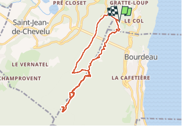

Length
10 km

Max alt
1427 m

Uphill gradient
864 m
Km-Effort
21 km

Min alt
616 m

Downhill gradient
864 m
Boucle
Yes
Creation date :
2023-05-27 08:54:03.201
Updated on :
2023-05-27 13:32:36.787
4h15
Difficulty : Easy

FREE GPS app for hiking
 SityTrail
IGN / Geographical institutes
SityTrail Plus
The world is yours!
About
Trail Walking of 10 km to be discovered at Auvergne-Rhône-Alpes, Savoy, La Chapelle-du-Mont-du-Chat. This trail is proposed by mzonzon05.
Description
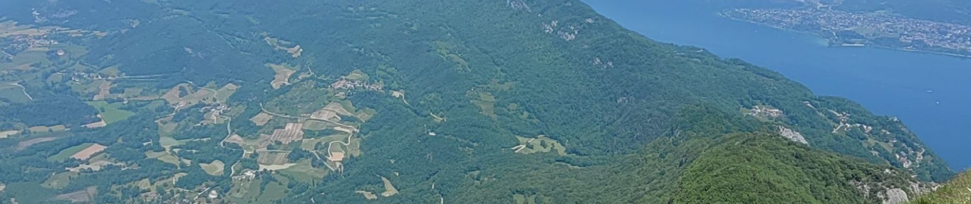
Jolie boucle. Les points de vue du Molard Noir et de la Dent du Chat sont magnifiques et permettent de voir tout Rhône-Alpes !!!
Certes il y a du monde !
Photos


Positioning
Country:
France
Region :
Auvergne-Rhône-Alpes
Department/Province :
Savoy
Municipality :
La Chapelle-du-Mont-du-Chat
Location:
Unknown
Start:(Dec)
Start:(UTM)
721818 ; 5063761 (31T) N.
Comments